Route n°13 - Le Tour des Lacs
Add to my favorites

High-altitude route: snow, ice, avalanches... we advise against these routes during the winter season.
Route closed
Warning: route to be carried out in good weather only, considering high mountain terrain borrowed.
Unmarked itinerary that will be done entirely with GPS.
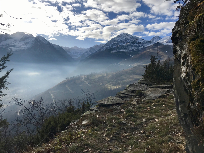
A tour that will allow you to discover all the beauty of the Haute Vallée du Louron with the mountain lakes of Pouchergues and Caillaouas.
The characteristics of the route.
Loudenvielle (65)
- Distance 20.88 km
- Elevation gain 1350 m
- Elevation lost 1350 m
- Min. elevation 1255 m
- Max. elevation. 2192 m
- Duration (depending on pace) 2h50 à 5h40
- Marking No trail-running signs
The first part of the climb will be done by a mountain trail, which is used by hikers to the Soula mountain hut. Afterwards, you will leave the crowd to reach a wild valley leading to Lake Pouchergues. From there, you will follow an old mine path. The path is wide but in quite portions expose with half-galleries dug into the mountain. All your attention will be mobilized.You will then reach Lake Caillaouas before starting the descent towards Pont de Part. There too, marmots and Izards in perspective.
Area : Pont de Prat
Report a problem
Topo Trail 13
Add your time and share your feelings
Services nearby
Refuge de la Soula

LES SAPINS Chairlift
MYRTILLES Lift
Val Louron
Le Nabias 1450
Val Louron
Le Lustou Residence
Val Louron


Follow us on
the digital trails
the digital trails


![]()
Info & contacts
Intercommunal Association of the Louron Valley
contact@louronbikeandtrail.fr
Tel. +33 (0)5 62 99 95 35
 Louron Bike & Trail - Parcours - Route n°13 - Le Tour des Lacs
Hello, world! This is a toast message.
Louron Bike & Trail - Parcours - Route n°13 - Le Tour des Lacs
Hello, world! This is a toast message.
Louron Bike & Trail - Parcours - Route n°13 - Le Tour des Lacs
Hello, world! This is a toast message.


OK
Annuler